By JESSICA DOLAN
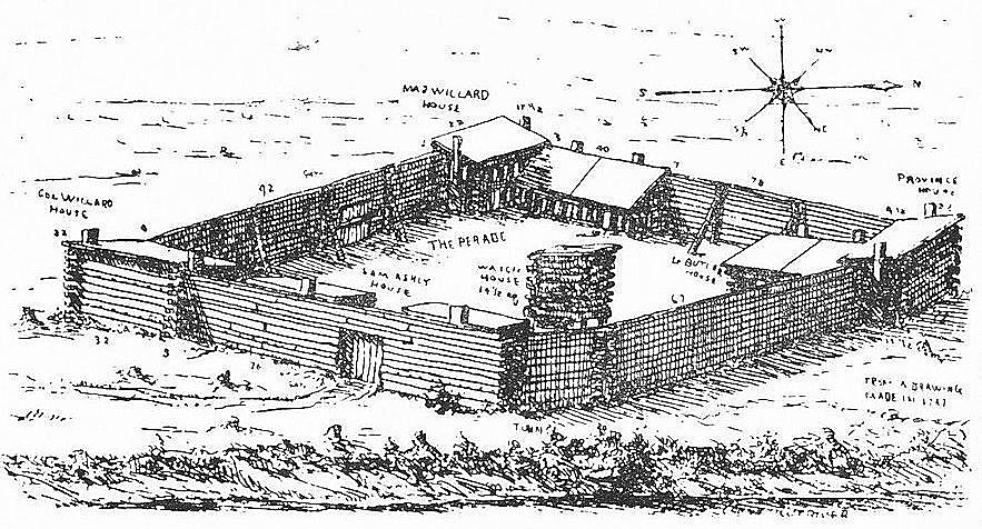
One of the historical sites in Brattleboro that is a key site for Indigenous history, and the history of competition between England and France to settle North America, is Fort Dummer. The history of Fort Dummer takes us into the beginning of the 18th Century, at a time when Sokokis, other Abenakis, and their Northern Seven Nations allies were trying to contain the English within the bounds of their existing colonies of Massachusetts, Connecticut, Rhode Island and New Hampshire, and prevent them from settling more Indigenous land to the North and West. Fort Dummer was the first European settlement in what later became Vermont; it was considered by the English to be a northern and western “frontier” of wilderness and Wabanaki territory. And yet, there is not much information about the fort, its land, and its site offered to residents or visitors of Brattleboro.
During the time that it was built and occupied, Fort Dummer was the “Frontier” between English settlements, and Wabanaki territory, to the North. If you can imagine, what later became Vermont was regarded by settlers at that time as a vast wilderness that stretched between where the English settled in what they called the colonies of Massachusetts, New Hampshire, and Connecticut, to the south, and where the French settled in the North, on the North and South banks of the Saint Lawrence river, that included the strongholds of Montreal and Quebec.
There were Native and settler villages along the Hudson River to the West, and in what later became New Hampshire, to the east; but the rocky, mountainous, riverine lands of Vermont were squarely Indigenous country, and thus, imagined to be “wild” by the British settlers. At this time, rivers such as the great Connecticut River, the West River, the Winooski, Otter Creek, and the Hudson, were the highways of travel, as Indigenous people traveled them by canoe, and portaged over land.
Native people of the Northeast frequently traveled between Eastern Wabanaki country, in what later became Maine, New Hampshire, and New Brunswick) and Western Wabanaki country (which later became New Hampshire, Vermont, and Western Massachusetts), as well as west to Mohican and Mohawk territory (in what later became known as the Mohawk Valley, Albany, Schnectady, along the Hudson, Lake George, and the Hoosatonic), east to Nipmuc and Wampanoag territory, south to Mohegan and Narragansett territory, and north to the territory of the Seven Nations: Mohawk, Abenaki, Algonquin, Nippising, and Oswegatchie territory, along the Saint Lawrence and in the greater Montreal area.
Thus, the site of Fort Dummer was located at a strategic confluence of travel routes: it was on the point just north of British settlement after which a number of rivers joined the Connecticut to flow south to the sea.