RETREAT FARM & MEADOWS
A Brattleboro Words Trail Site

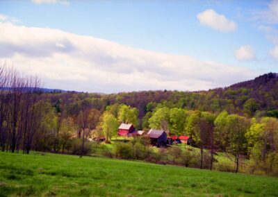
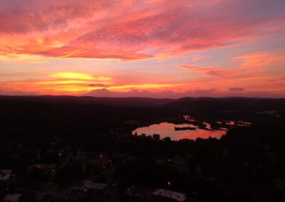
A birds-eye view of the Retreat Meadows at sunset.
A Land Acknowledgement
As with most places in the United States, Brattleboro was built on stolen land. Through the process of colonization, European settlers did everything they could to remove Indigenous Peoples from their homelands. In this place, those People are the Sokoki Abenaki – in their own language, the Sokwakiak, the People Who Separated. Despite those ongoing policies, the Abenaki have continued and their native tongue, Aln8ba8dwaw8gan – the Western Abenaki language – is being renewed in affirmation of the Land of its origin. They know this place as Wantastegok, At the River Where Something is Lost, situated at the confluence of the Kwenitekw (Connecticut River) and the Wantastekw (West River). The lands and waters of this place continue to hold their stories.
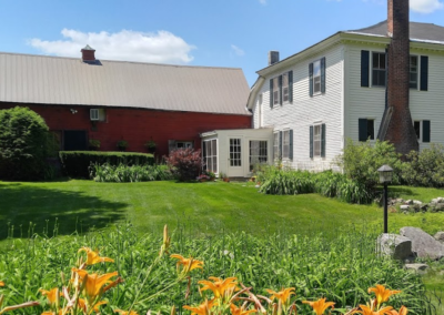
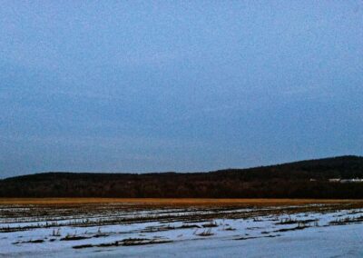
In the heart of Brattleboro there’s a calm, sprawling body of water perfect for lazy boating, skating and ice-fishing, summer swims and skipping rocks. This is the Retreat Meadows, named so because in the 1830’s, when the Brattleboro Retreat hospital was founded, the area was still fertile farmland. A remnant of that time has survived—the Retreat Farm, which has hugged the meadows’ shore since 1837.
At first glance you might mistake the Reatreat Meadows for a lake, but this is in fact where the West River meets the Connecticut River. To the Indigenous people who have lived here for thousands of years, this place is sacred.
Before the construction of the Vernon hydroelectric dam downriver on the Kwenitekw in 1909, the now-flooded meadows—known as mskodak in Aln8baiwi, the Abenaki language—were prime farmland for the Indigenous who dwelt here, and subsequently the European settlers that arrived in the mid-1700’s. Like so many places we live and play today, the story of the Retreat Meadows and Farm has been written over another, much longer story—a story that is anything but over.
The Petroglyphs at Wantastegok
In the waters of the Retreat Meadows, near the confluence of the Wantastekw (West River) and the Kwenitekw (Connecticut River), sits one of only two primary petroglyph sites within the borders of today’s Vermont. The other is 25 miles upriver at Ktsipôntekw, the Great Falls (Bellows Falls).
The carvings on a ledge outcropping at the south bank of the Wantastekw/West River are now submerged, covered by the rising waters caused by the construction of the Vernon dam 8 miles downriver in 1909.
They include multiple thunderbird figures, a canid, and snake-like shapes, first documented in writing by Samuel Williams in The Natural and Civil History of Vermont (1794) and, later, by Edward Augustus Kendall in Travels Through the Northern Parts of the United States, in the Year 1807 and 1808 (1809).
Interpretations of these markings have changed over the years, depending on the worldview of the observer, and range from dismissive to thoughtful. Today’s Abenaki people consider this a sacred site: the ancestral messages in stone still remain relevant. Scholars place the date of the carvings at perhaps 3000 years old.
“Petroglyphs are not just a billboard in the wilderness. They’re in certain places for certain reasons…the fact that they’re here tells you that there’s something larger going on.”
— Rich Holschuh, Vermont Commission on Native American Affairs

An 1866 image shows what is known as Indian Rock, one of the two known petroglyph sites in Vermont. It has been submerged the Retreat Meadows since 1909. Courtesy of the Vermont Historical Society.

Annette Spaulding diving in search of the West River petroglyphs. Courtesy Annette Spaulding.
Words on the Water: Stories of Wantastegok, the West River, and Abenaki Presence
In August of 2019, the Words Project invited Brattleboro to gather on the waters of the Retreat Meadows for a special celebration of the West River petroglyphs and our region’s enduring Abenaki presence. Diver/Explorer Annette Spaulding, Rich Holschuh, and Dr. Jessica Dolan shared their research from pontoon boat while guests viewed from The Marina’s outdoor deck and from their own boats, kayaks, and canoes gathered around in the water. View a BCTV-produced video of this special event below.
Brattleboro Students on the Meadows
This two-part podcast produced by Joe Rivers and his Brattleboro Area Middle School students recount the story of the Vernon hydroelectric dam’s construction in 1909, giving background to the flooding of the Meadows and the destruction of a critically important site for the Sokoki Abenaki by the construction of the Vernon hydroelectric dam early in the last century.
These student podcasts are not included in the final Brattleboro Words Trail audio stories.
Part One
Part Two
On The Map
45 Farmhouse Square, Brattleboro, VT 05301
Retreat Farm & Meadows
About the Research sites
The Brattleboro Words Project is working with the community to identify specific sites and themes significant to the study of words in Brattleboro and surrounding towns. Research Teams – classrooms/teachers, amateur historians, veterans, writers, artists and other community members — will produce audio segments and other work to be incorporated into audio walking, biking and driving tours tours.